Trove records state: The motte occupies the crest of a ridge and is surrounded by a 12 ft wide ditch, now shallow and almost obliterated on the west side, which appears to be drawn out towards a point on the NE.
The mound is 25 ft. high on the N and W and about 40 ft. high on the S. The summit, wrecked by the construction of an observation post during the second World War, measured about 60 ft. by 52 ft. with an 8-10 ft. wide bank around the edge, within which was a 5 ft. wide ditch which separated it from a 7 ft. 6 ins. wide concentric bank enclosing a 12 ft. diameter central area. This inner enclosure was destroyed by the digging of a large pit during the construction of the post.
Balgreggan Mote is generally as described except that the ditch survives only on the east, where there is a slight outer bank above the steep natural slopes. The summit is now featureless save for a circular concrete slab, the remains of the observation post, at the centre.
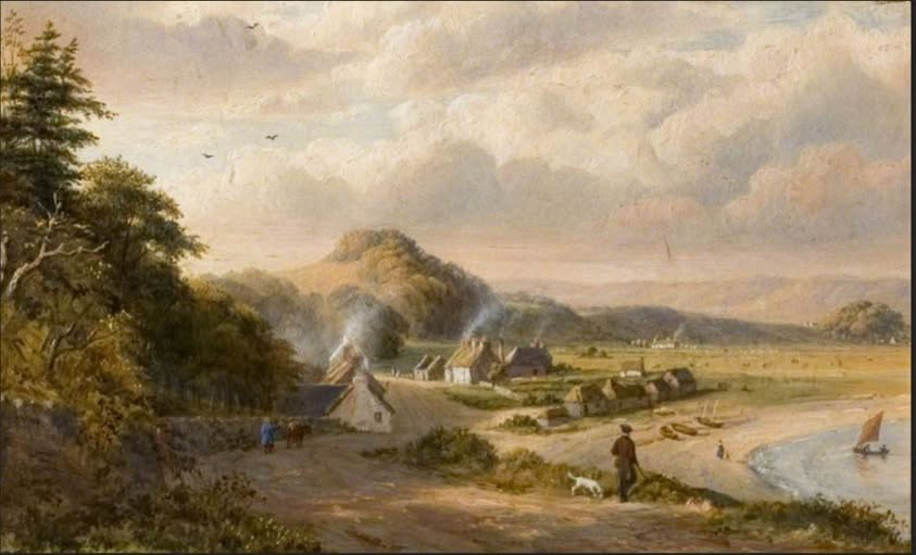
The name of the motte is interesting – most likely Baile Graigain ‘farm or settlement of the wee village, hamlet’, presumably referring to Sandhead, in the painting below. The motte was named from the nearby farm of Baile Graigain at NX 089 500.
Graig is quite common in Irish Gaelic place-names (see PW Joyce) but I’m not aware of other examples in Scotland?
Curiously Roy records another fortification name on top of the slope to the left of the nearest cottages in the painting, on what is now called Drumdally Hill (Druim Deilge ‘thorny ridge’). The fortification (if that is what it was) is called by Roy Castle McDougall for Caisteal Mhic Dubhghaill ‘MacDowell’s Castle’. However there is no record of this fortification as far as I’m aware and nothing apparent on aerial photos or LIDAR.
Painting by Robert George Kelly (1822-1910), courtesy of Stranraer Museum— in Sandhead. (thanks to Edward Beck for posting this on I Love Drummore FB page)
Leave a Reply